Is sharing the border with Indian and Kalay-Tamu border trade cities along the India-Myanmar border. Kalay-TaMu road in Myanmar and Imphal main road in India played a vital role at the time of the World famous Imphal Operation in March 1944. Sagaing Division is a golden land for Myanmar too. A major gold mine in Myanmar is the Kyauk Pahto Mine, which is situated near Banbway Gone in Salingyi Township, Sagaing Division. Moreover, the person who are interested in eco-tourism and visitors can visit and study many places in and around Sagaing and the Sagaing Division such as Alaungdawhathatpha wild life sanctuary, Tuintaung, well spirulina produce and Shwebo, King Ataungmintayar U Aung Zay Ya, that founder of third Myanmar Kingdom reside it. It is also homes for Nagas, one of the primitives are residing in the Northwest Montain region of Myanmar close to the Indian border. The Naga Traditional New Year Festival called Kainbi festival.
Shwebo:
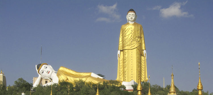
Shwebo is a rice-collecting centre on the railway about 50 miles (80 km) north-northwest of Mandalay and 17 miles west of Kyauk Myaung, a river-side town on the Ayeyarwady, which is famous for glazed pottery works from toys, cups, letters, bowls, pots to huge water jars that are tied in hundreds and floated down the river as rafts. These are widely used throughout the country. Shwebo was the birthplace of Alaungpaya, founder of the Alaungpaya dynasty (1752–1885), and is the site of his tomb. The palace and other royal parks, lakes, moats and watch tower have been neglected, disrepaired, ravaged and ruined in the last two centuries. With the promotion of the tourism industry, the government has launched upon the reconstruction of the palace buildings, parks and dredged the royal lake for the benefit of the visitors and locals.
Monywa & Pho Win Daung:
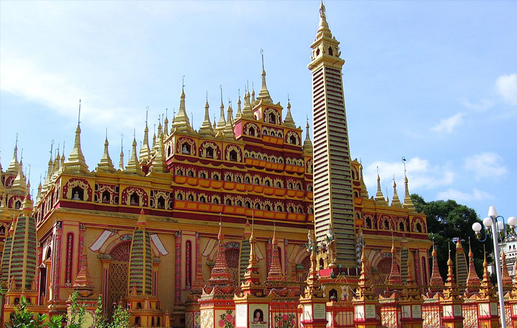
About 136 km to the west of Mandalay lies Monywa, the commercial center of the Chindwin Valley or northwestern Myanmar. Places of interest include Thanbokde Pagoda, with over 500,000 Buddha images; Bodhi-ta-taung (one thousand Bo trees): Ledi Kyaungtaik, a teaching monastery where Buddhist scriptures are inscribed on 806 stone slabs: and Kyaukka Village, known for its own distinctive style of lacquerware. Just on the other side of the Chindwin River and a 30 minutes drive by pick-up is the seldom visited 15th Phowin Taung temple complex where more than 450,000 sandstone Buddha’s were carved in the hillsides in caves, alcoves, or tiny niches. The cave murals are still intact with indigo blues and soft pastels. Many of the Buddha’s can be seen without entering the caves or niches and footwear is permitted as long as one is not entering the sanctuaries. A stunning Buddha not to be missed is the reclining Buddha resting on a rectangular stone mosaic which shimmers with cut glass."
Kalewa:
Is the main port on the Chindwin River for trading with India just 40 miles (60km) away; here you can visit the lively market or nearby Kalayemo, an interesting town near the Chin State border where there are two good markets.
Kalay:
One of the famous towns in Sagaing Division, named Kalay can be reached by boat from Monywa. Kalay touches Chin State and is one of the gateways to enter the Northern Chin State by road. Kalay (situated 35 km from the Indian Border) was the administrative capital of this area rich of Teak forests. It is a pleasant colonial town with its golf course surrounded by splendid colonial houses built by the Bombay Burma Trading Corporation in the 1920’s and 1930’s (there is still a small community of Indians that used to work for the Scottish company and their descendents). The governor’s house, the administrative building, the school, the hospital, the “Dak Bungalows”, the headquarter of the company are well preserved, still in use nowadays and nicely maintained.
Htamanthi:
Was once notorious or famous, depending on your perspective, as the place of were-tigers. There are about 200 houses in Htamanthi. You can see some women weaving the traditional blankets.
Layshi:
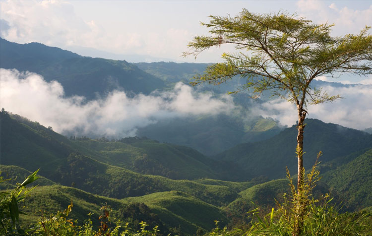
Is around 1000ft to 12553ft above sea level. It rises higher to the south and is a bit flattened to the east and the south. To the west and the north, the place is filled with hillocks, mountain ranges and valleys. The area encompasses approximately 1057 square miles. The temperature is around 15 degree Celsius in summer (March to May) and 5 degree Celsius in winter (November to February). The estimated rainfall is between 60 to 120 inches per annum and the rainy season is from June to October. The road to Layshi is slippery nearly the whole year because of the mud and rain. There is even a road called Myauk Chaw Le Taung (Mountain where even a monkey slips). It is approximately 56 miles and almost vertical cliffs on one side with deep gorges on the other. There are some orange gardens near Layshi. You can also view the traditional weaving there. The Nagas normally build their villages on high ground to make it inaccessible and to protect themselves from marauding enemies.
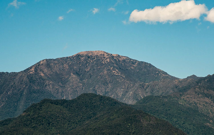
Mt. Saramati:
Mt. Saramati (3841 meter) is the highest in Nagaland and it remains snow covered during winter. The mountain range is covered with rich, natural and diverse forests, visible at
various altitudes, ranging from sub-tropical ever green and semi ever green to temperate broad leaved and Alpine vegetation. It also has good bio-diversity with natural flora and
fauna and various kinds of orchids.
The Naga Hills:
The Naga belong to the Tibeto-Myanmar group that diverted to the west. There are 49 sub-groups differentiated by their spoken language. The southernmost point of the Naga Hill Tracts is the sources of the Chindwin River and the northernmost point is India-Myanmar border. The Naga can be found on both sides of the India-Myanmar border. They live mostly around the Patkoi Ranges and on the western hills of the Chindwin River's sources. The Naga costumes must be among the most colorful in the country. Feathers, fangs, teeth, brass, beads, intricate weaving; they wear everything in every colour. The females tattoo their foreheads and chins. Naga's biggest festival is New Year festival of January 15th, called Kaing Bi and organized by Naga festival committee who choose each year's festival location and details under the control of central government. All Naga tribes send a few delegations to this occasion, thus it is the perfect opportunity to see variety of different Naga people at once.
TANINTHAYI DIVISION:
Adjacent to Mon State to the north and Thailand to the east. Taninthayi Division occupies a long narrow coastal plain bounded by the Andaman Sea in the east, which runs to Kawthaung, the most southerly point of Myanmar and which then continues to the Malaya Peninsula.
Dawei:
The capital of Taninthayi (Tenasserim) division, is a port of medium importance and tropical seaside town. 384 miles from Yangon, it is on the eastern bank, at the mouth of a creek of same name, 30 miles from the sea in a narrow gulf. As Dawei is in the coastal region, fisheries become the mainstay of the economy there. Sea-fish and prawn are sufficient enough not only for local consumption but also for the international market. Most local people make their living by trading in regional goods. Some have rubber, oil palm, cashew and mango plantations and they also cultivate paddy. This is a wrap-up of the simple Dawei people’s life and breath-taking beauty spots of Dawei which today boosts modern characteristics of developed cities. The well-known Maung Ma Gan Beach, which is now being developed and upgraded is just 8 miles north-west and is famous for delicious sea food.
Myeik:
According to the characteristics of port cities, Myeik is busy with small and large boats in the morning. Beside, you can pay homage the Reclining Buddha Image, the grace and glory of Myeik on Pahtet isle. At the harbors of Myeik, ships, speed boats and fishing vessels are closely quad in a long line. Relying on the sea, cold storage factories for packaging fish and prawn, ice factories and warehouses are built along the bank. The house of bird-nests is a rare and unique thing to see in Myeik. The local people are very much devoted to religion. The Lay Gyun Se Mee Pagoda in Myeik is very sublime. Its festival is thronged with visitors. During your stay in Myeik you should not miss the Beik evening Bazaar. The reclining Buddha Image in Pa Htaw Pa Htat island, which is on the other bank of Myeik, is also very sublime.
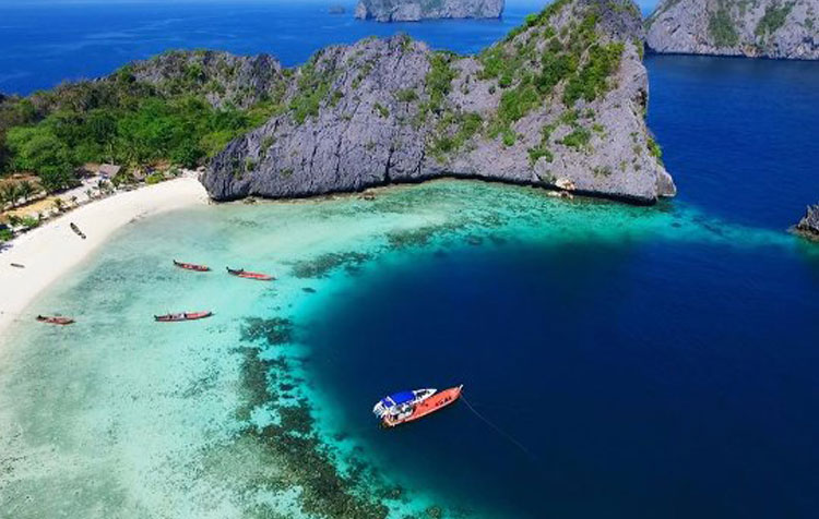
Kawthaung:
Formerly called Victoria Point, is the southern-most town of Myanmar and the starting point to explore the Mergui Archipelago. Half of the town is going up along the slope. The town is an important border point with products such as seafood, palm oil and rubber. You can observe the states of King Bayintnaung in Kawthaung which is a symbol of Myanmar Patriotism. The world's largest pearl was discovered in the Makha lauk pearl oyster exploration area in the north west of Zardatgyi Island in Kawthaung Township. Ranong is the border town in Thailand. Visitors can take 20 minutes boat trips to Kawthaung for sightseeing and shopping. Andaman Club on the Thahtaykyun island is located west of Kawthaung. There are regular flights from Yangon to Kawthaung and Five Star shipping line operates Cruise vessel to Kawthaung.


